察哈尔右翼前旗至丰镇公路设计(三)(含CAD图)
无需注册登录,支付后按照提示操作即可获取该资料.
察哈尔右翼前旗至丰镇公路设计(三)(含CAD图)(任务书,开题报告,外文翻译,论文计算书19000字,CAD图纸14张)
摘 要
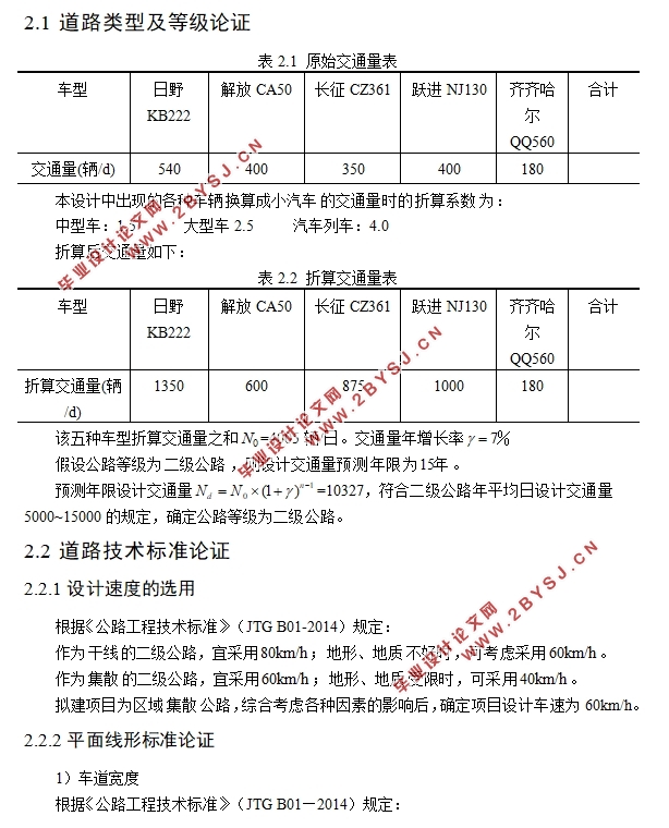
本设计主要介绍了内蒙古地区集宁市至丰镇市的一段山区公路的设计过程。设计起点为长朋沟,终点为五股村。在进行本次设计时,首先是认真研读老师给出的资料,对设计路段的各种地理交通数据以及地形地质、水文气象等自然条件信息有了初步的了解。在自己进一步查阅资料的基础上,依据《公路工程技术标准》、《公路路线设计规范》等现行规范进行本次设计。
首先根据交通量计算出道路等级,然后进行道路的技术标准论证,将设计中所需要用到的各种参数从规范中提取出来,形成自己的设计方案指标。接下来就应该根据当地的地形地貌、水文地质等参考条件在地形图上进行选线工作,在进行选线工作时,应当选择两条线路,然后通过比选论证,选择更优方案进行下面的设计。
选线结束后,就进入了本次设计的主体部分,既路线的平纵横设计。并且需要在边坡设置支挡防护结构,在特殊路段进行挡土墙设计。在特殊地形地段,根据实际地形情况进行桥涵设计。最后进行路面设计,在进行路面设计时我设计了两种路面方案,通过对比论证选择了更优的方案一。并且需要对路面排水进行讨论,根据实际情况设计不同的排水方案。
关键词:公路等级;纵断面;路基;路面;支挡防护;排水;挡土墙。
Abstract
This design mainly introduces the design process of a section of mountain highway from Jining to Fengzhen in Inner Mongolia. The design starts at Changpenggou and ends at Wugu Village. In this design, the first step is to carefully study the information given by the teacher, and to have a preliminary understanding of the various geographic traffic data and natural conditions such as topography, geology, hydrology and meteorology of the design section. On the basis of further consulting the data, the design is carried out according to the current specifications such as Highway Engineering Technology Standard and Highway Route Design Code.
Firstly, the road grade is calculated according to the traffic volume, and then the technical standard of the road is demonstrated. The parameters used in the design are extracted from the specifications to form the design index. Next, we should select the line on the topographic map according to the local terrain and geomorphology, hydrogeology and other reference conditions. In the process of line selection, we should select two lines, and then through comparison and demonstration, choose the better scheme to carry out the following design.
After the route selection, it entered the main part of the design, which is the horizontal, vertical and horizontal design of the route. It is also necessary to set up a retaining structure on the slope and design the retaining wall in the special section of the road. In the special terrain area, the bridge and culvert are designed according to the actual terrain. Finally, the pavement design, in the pavement design, I designed two kinds of pavement schemes, through the comparison and demonstration, I chose the better one. It is necessary to discuss the drainage of pavement and design different drainage schemes according to the actual situation.
Keywords: highway grade; vertical section; roadbed; pavement; retaining protection; drainage; retaining wall.
设计道路的主要技术标准
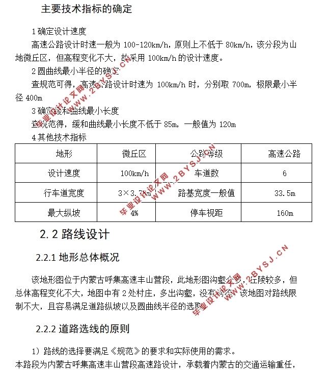
该道路为新建的一条二级集散公路,设计速度60km/h。一般来说,集散公路对线性要求比较低,有利于在这种复杂的地形下选线,同时该地区的施工也有一定的难度,路线选择时应倾向于易施工的路线。
该公路为修建在 地区的集散二级公路,设计速度60km/h。通过具体分析,在该路线上除起终点以外共设计了5个控制点。公路平面设计时,所有的控制点均应设置圆曲线,圆曲线半径大小应该通过设计速度和转角大小共同确定。
通过查阅 (JTG D20-2017),在各控制点选取了合适的 半径,并选取了合适长度的缓和曲线使路线整体看起来美观顺适。
本次设计中的圆曲线最小半径为500m>规定的圆曲线最小半径250m,符合规范。
确定标准横断面
该设计公路为 公路,设计速度 。
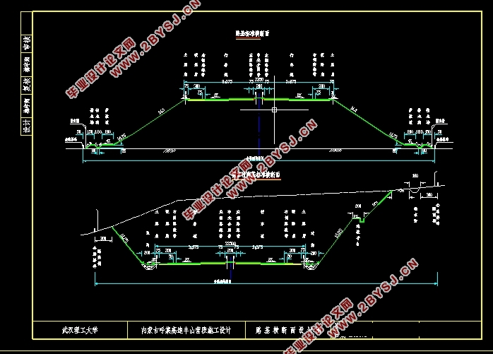
通过查阅 (JTG B01-2014),得到该公路标准横断面如下:
路基全宽 。其中,左侧 宽3.5m,左侧 宽0.75m,左侧 宽0.75m。右侧路基与左侧完全一致。对于填方路基,确定路基边坡坡度为1:1.5,行车道 为2%,土路肩为3%。路基边沟采用梯形边沟,边沟高宽均为 ,沟内侧坡度均为 。对于挖方路基,路堑 均设置为1:125,截水沟高宽均为 ,坡度均为1:1,其余与填方路基一致。


目录
第1章 绪论 1
1.1 概述 1
1.2 沿线自然条件 1
1.2.1 地理位置 1
1.2.2 地形地貌及植被 1
1.2.3 水文地质条件 1
1.2.4 气候条件 2
1.3 公路修建的目的与意义 2
第2章道路技术标准论证 3
2.1 道路类型及等级论证 3
2.2 道路技术标准论证 3
2.2.1设计速度的选用 3
2.2.2平面线形标准论证 3
2.2.3竖曲线要素标准论证 6
2.2.4净空高度论证 7
2.2.5汽车荷载论证 7
第3章 路线设计 9
3.1 影响路线方案选择的主要因素 9
3.2 路线方案拟定 9
3.3 具体路段分析 10
3.4 路线方案比选 13
第4章 路线平面、纵断面设计 16
4.1 平面线性设计 16
4.2平曲线要素计算 16
4.3 路线纵断面设计 19
4.4 竖曲线要素计算 19
第5章 路基横断面设计 21
5.1 确定标准横断面 21
5.2 路基加宽、超高设计 21
5.3路基设计 21
5.3.1设计原则 21
5.3.2 一般路基设计 21
5.3.3 路基压实标准 22
5.3.4 特殊路基设计 23
5.4 土石方计算及调配 23
5.4.1 土石方计算 23
5.4.2 土石方调配 23
5.5 路基防护设计 24
5.6 路基挡土墙设计 24
第6章 路面设计 30
6.1 设计资料 30
6.1.1 自然条件 30
6.2 路面方案 30
6.2.1 方案选择 30
6.2.2 路面参数选取 31
6.2.3 初拟路面方案 35
6.2.4 设计材料参数 36
6.3 路面结构验算 37
6.3.1 方案一验算 37
6.3.2 方案二验算 40
6.4 方案比选 42
第7章 排水设计 43
7.1 概述 43
7.2 路基排水设计 43
7.3 路面排水设计 44
第8章 桥涵设计 45
8.1 概述 45
8.2 涵洞设计 45
8.3 桥梁设计 45
参考文献 47
致 谢 49
